This Blog is in relation, to a small townland, between The Moy and Killyman, called Listamlet,( as Gaeilge), Liostamlaght, Lios Tamhlachta, (fort of the burial place) (plague burial place ), and as Tess Fox told me, there was a really old burial place, where Coyne’s house is now, at the time I didn’t understand what she meant until later she explained about the plague, and how for generations Listamlet inhabitants with pride pronounced it in the Gaelic way Liostamlaght. The Fort it’s said is up at the back of Fee’s on Listamlet hill, also known locally for some unknown reason, as ‘Goat Hall’, it was also the location of a later Christian burial site, maybe for children who died before being baptized, and in accordance with the Church at the time, couldn’t be buried in sacred ground, or maybe it was from inhabitants who died during an gorta mór. James McKearney attended a history meeting in the 60s and came home with a map of this Christian burial site, I hope this will turn up again.
Listamlet was sacked in August 1880
Listamlet had its own AOH hall, and band, it was burned and then, rebuilt after the second world war
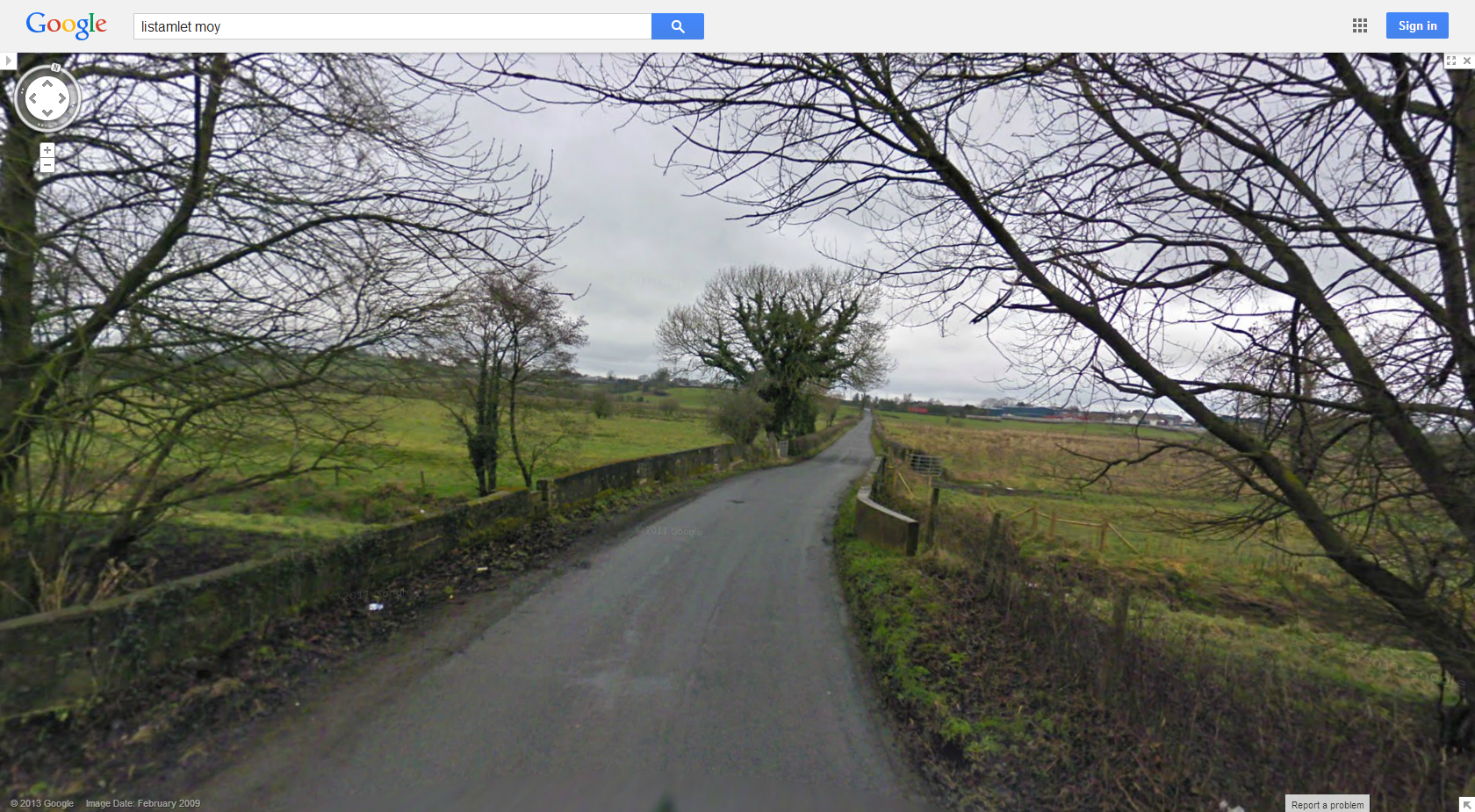
We even had the American army here, during WW11, they were given a guide book prior to arrival, in the North, when they, arrived in the Moy area, they fixed up and strengthened the bridge down at the Rhone river, it was said by Charlie Fox, they the American army camped in the field to the right of Fox’s, while the work was being done, the Army was based in the Moy area , along with other regiments etc, in the six counties. Benburb had a military hospital, as mentioned here, Trew and Moy station, the Argory and Derrygally house, also had troops, it’s mentioned here, I assume having a good stable bridge, at the Rhone river, would have been a must, when moving heavy, vehicles and ordnance. Pre running water Listamlet, had a pump, at the bottom of Listamlet hill, to the left in John Joe Donnelly’s field. I have lots to do regarding the history of Listamlet, I have a Newspaper section where I add articles in no particular year order, relating to Ireland back in the day, I just add them randomly, times were just a bit simpler back then, but just every bit as interesting before we had Sky Tv and the Xbox. Also check out the Picture Page of folk from in and around the area and a Page on places around the area.
The meaning of Listamlet, Liostamlaght, (Fort of the burial place)
As mentioned briefly above, I’d like to give a better explanation of the meaning of Listamlet,
Most of our place names come from the Irish language. The English versions we have today are largely a result of either translation, AnMainistir Liath > ‘Greyabbey’; Cionn Bán >‘Whitehead’, or an attempt to capture the Irish sound in English spelling, Áth na Long >‘Annalong’; Cill Chaoil > ‘Kilkeel’; Doire >‘Derry’; Dún Geanann > Dungannon; An Lorgain> Lurgan. This second category can give rise to extraordinarily long placenames such as‘Ardloughnabrackbaddy’, Ard Loch na mBreac, Béadaí ‘the peak of the lake of the fussy trout’,in Kilmacrenan, Co. Donegal, or the even longer Sruffaunoughterluggatoora’ on the Aran Islands,a version of Sruthán Uachtar Log an tSamhraidh‘upper stream of the summer hollow’.Place names tell us about Ireland’s topography, its mountains, swamps and lakes, as well as agricultural practices, religious sites, battles and invasions, folklore and legend. Our placenames can link us to our pre-Christian past when old Gods gave their names to places and rivers, the name Eire Ireland is from the old Irish Eriu meaning “fertile land” Eriu is seen as a sovereignty or fertility goddess and is associated by some with sun worship In pre-Christian Ireland, buildings of all the various kinds were round, including domestic dwellings, defensive fortifications and burial mounds. These buildings were known as, lios, dun, rath, cathair, brugh etc, names which still apply today. Some of the ancient manuscripts record the building of these forts, not in the sense of a military fort, but more an enclosure were a small community, possibly from the same family, would have lived farmed, stored crops, the rath, were the enclosing banks for protection, and the lios was the open space within, were round houses, would have been built for living, using whatever local resources there was available, stone or wattle and daub, for the walls and probably thatch for the roof. There are 1400 town lands and villages throughout all parts of Ireland whose names begin with the word ‘Lis’. ‘Tamhlacht’ is often associated with religious sites too and is translated as a ‘sanctuary or a place set apart’. Most of the latter occur as ‘Tamlaght’or ‘Tamlaghtmore‘ and appear to refer to plague burial grounds, the first mention is in 2379 BC, it states that After flourishing for 520 years, their numbers reaching 9,000, all the Partholonians die of the plague within one week in May. Taimhleacht Muintire Parthalain marks their burial. This may be a mound on the Hill of Slane which is rumoured to be one of their burial places.”Tamhlacht” = Plague Monument. There are about a dozen “Tallaght/Tamhlacht” place names in Ireland; e.g., Tallaght, a suburb of Dublin. Parthalonians are Mythical early invaders of Ireland, according to the pseudo-history Lebor Gabála [Book of Invasions]; they are named for their leader, Partholón [Latin Bartholomaeus]. Arriving from the eastern Mediterranean 312 years after the death of Cesair, the leader of the previous invasion, the Partholonians are the first invaders after the Flood and precede the invasion of the Nemedians by thirty years. They often do battle with the predatory Fomorians, nominally the fourth invaders, who prey upon successive inhabitants of Ireland. Under their leader, Cichol Gricenchos, the Fomorians appear hideously misshapen, with only one eye, one arm, and one leg. A beneficent and productive people, the Partholonians clear four plains, form seven lakes, introduce agriculture, and are the first to divide the island into four parts. They also establish the first civilization, fostering law, cauldron-making, crafts, ale-brewing, and hospitality. Their impermanent settlement touches different parts of the island. Landing first at Inber Scéne [Kenmare?] or Donegal Bay at Beltaine time, they settle near Assaroe but later cultivate Mag nElta [Moynalty], the plain between Howth, Clontarf, and Tallaght, coextensive with the modern city of Dublin. It has been told by our previous, and present generations that the Fort was at the top of Listamlet Hill, John Joe Donnelly told to me that the mud, that was used in the construction of the mud wall houses in Listamlet, came from the top of Listamlet hill, which would explain what happened to any rath which was the enclosing bank, that would have fortified the lios, and also with the building of houses on the site greatly changed the lios and the rath forever.
Anthony Fox | Create your badge


anyone looking to contact me, about this wee page, please free to do so at listamlet@mail.com
LikeLike
This is a very interesting article and should be published in Duiche Neill
LikeLiked by 1 person
thanks Brendan & thanks to for stopping by
LikeLike
Im trying to trace my ancestors and need your help.
Im trying to find Martha Jane Murray (nee Dennison) married Thomas Murray on the 9th Feb 1942 at St James Church
LikeLike
Hi there Shane unfortunately I don’t do genealogy, were did they live in Moy or Listamlet?
LikeLike
They lived in Moy.
Martha was from Castlederg originally and married a Thomas Murray and went on to have 6 children
LikeLiked by 1 person