


A copy of Bartlett’s 1602 map of Ulster, showing the Rhone river
Little is known of Richard Bartlett, refered to as the Queen’s last map maker, Sir John Davis gives an account of Bartlett arriving with Mountjoy between 1600-1602, and tells of his untimely death in Donegal
‘1609, ’for one Barkeley being appointed by the late Earl of Devonshire [Lord Mountjoy] to draw a true and perfect map of the north parts of Ulster (the old maps being false and defective), when he came into Tyrconnell the inhabitants took off his head, because they would not have their country discovered’
Bartlett’s maps were used solely for English military use, the Rhone wouldn’t have been added unless it was being used by the English.
,
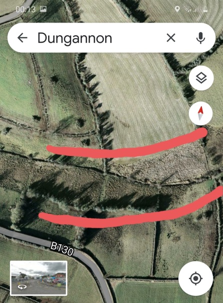
The Rhone or in the Irish ‘An Abhainn Rua’ (THE RED RIVER) ‘The Red River’ is aproxamitly 7 miles long, it starts it’s journey at a small lough on the Granville road, known locally as either Paddy Barker’s lough, or Cahoon’s lough the Rhone river runs from here to the Argory where it enters the Blackwater river, the Rhone also used to run where the Ballygawley line is now which is shown in Barlett’s 1602 map, Paddy Faye remembers this stretch, which is completly gone from the landscape


Crossing at the Derryfubble road

The outline clearly shows a much wider river back before the drainage schemes etc came in

Finishing at the Argory


thats fantastic Anthony. well done Will try to see what we got in relation to photos etc.
LikeLiked by 1 person